The St. Johns River Water Management District is continuing to monitor Tropical Storm Nicole as it moves across the state and stands ready to assist our state, regional and local partners in their response efforts.
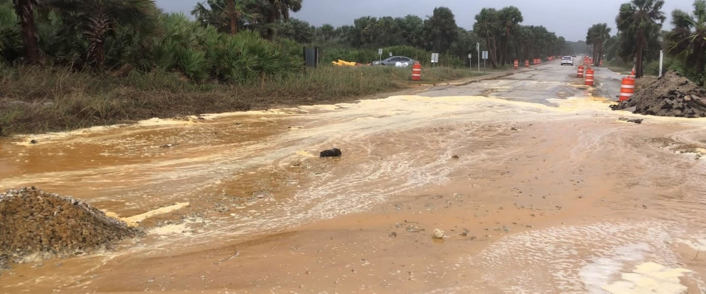
Tropical Storm Nicole’s strong storm surge breached sand dunes along A1A during high tide this morning in Flagler County, causing water and sand to flow onto side streets as well as across A1A in several areas. District staff was deployed to assist Flagler County by providing three pumps to help address the associated flooding.
“One of our priorities during a storm event is to ensure we are ready and able to assist our partners in their recovery efforts,” said St. Johns River Water Management District Executive Director Mike Register. “We have a strong partnership with Flagler County and are glad that we were able to provide assistance.”
Local governments are the primary entities responsible for emergency responses during storms, such as implementing state-of-emergency declarations, evacuations, and rescue efforts during flood-related disasters. However, if additional resources are needed, they can contact the Florida Division of Emergency Management’s State Emergency Team (SERT), which is tasked with providing disaster assistance to residents across the state. In this case, the District had the equipment needed and was able to respond immediately to the request.
District staff is also continuing to monitor water levels in the St. Johns River. Many areas along the St. Johns River, from Lake Harney north through Astor, are already in minor or moderate flood stages after Hurricane Ian. Additional rainfall will increase river levels, and flooding is expected along the St. Johns River’s middle (central Florida) and lower basin (northeast Florida) as a result of Tropical Storm Nicole. If we experience a strong and persistent northeast wind like during Hurricane Ian, the winds can drive water from the mouth of the river south, which can exacerbate the flooding in the middle basin.
Also, consider that tides and storm surge from the ocean influence the middle and lower St. Johns River. Water levels in the northern reaches of St. Johns can rise with little advance notice.
It is important for residents to stay vigilant and to follow the guidance provided by their county’s Emergency Operations Center, as they are the primary entities responsible for emergency responses during storms, including evacuations and rescue efforts during flood-related disasters.
At this time, all District lands remain closed. Please check the District’s website for the latest on land re-openings at https://www.sjrwmd.com/lands/recreation/announcements/.
Visit the District’s website at www.sjrwmd.com/localgovernments/flooding/ for information and links to flood statements and warnings, river stages, and local government emergency contacts.
For more information about state recovery efforts, please visit the Florida Division of Emergency Management’s website at www.floridadisaster.org/sert/emergency-support-functions/.
About the St. Johns River Water Management District
St. Johns River Water Management District staff are committed to ensuring the sustainable use and protection of water resources for the benefit of the people of the District and the State of Florida. The St. Johns River Water Management District is one of five districts in Florida managing groundwater and surface water supplies in the state. The District encompasses all or part of 18 northeast and east-central Florida counties. District headquarters are in Palatka, and staff also are available to serve the public at service centers in Apopka, Jacksonville, and Palm Bay.
For more information about the District, please visit www.sjrwmd.com.


Comments
No comments on this item Please log in to comment by clicking here