From the National Hurricane Center
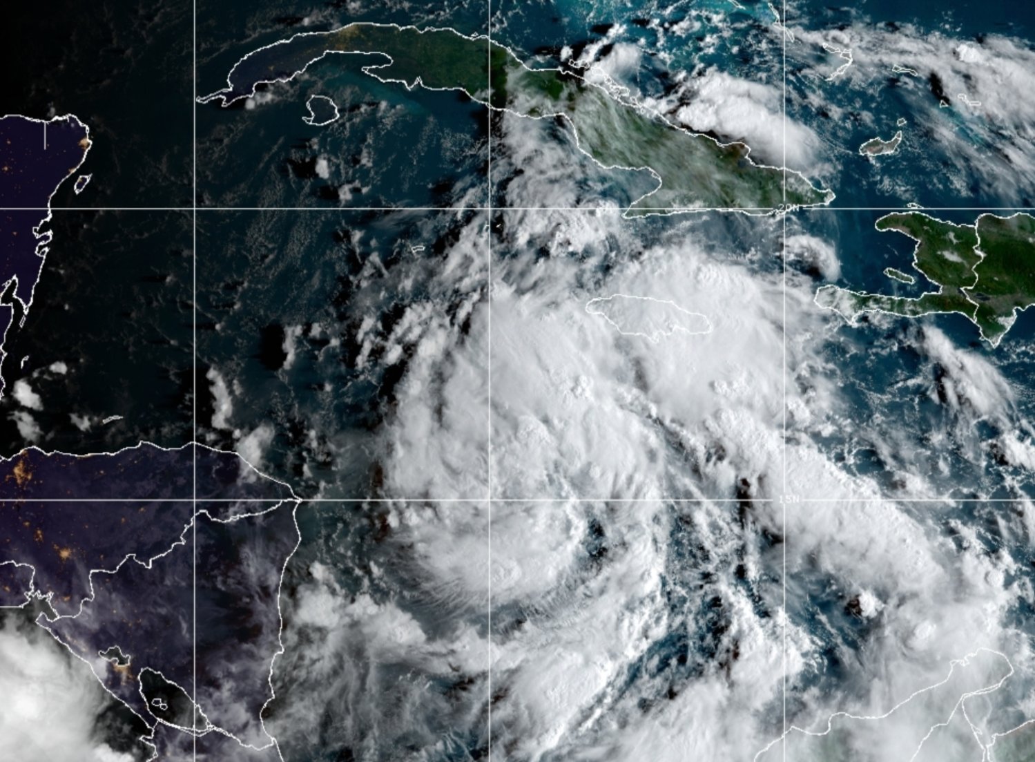
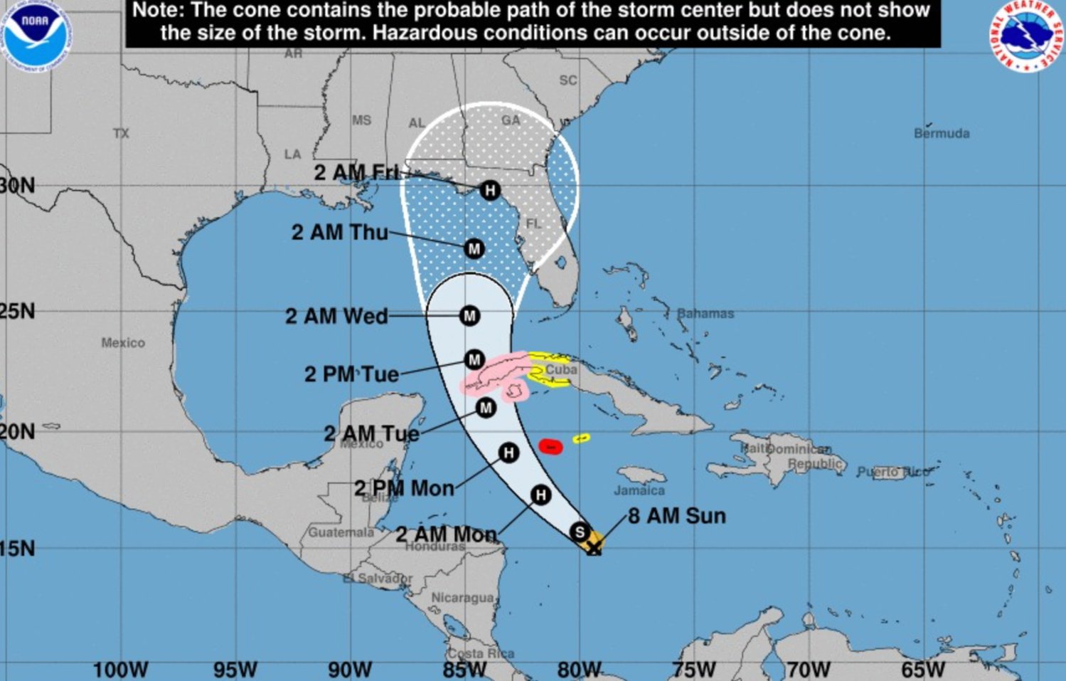
At 8 am, the center of Tropical Storm Ian was about 320 miles south-southeast of Grand Cayman. Ian is moving toward the west-northwest near 12 mph, according to the National Hurricane Center.
A turn toward the northwest at a similar forward speed is expected later today, followed by a turn toward the north-northwest on Monday and north on Tuesday.
On the forecast track, the center of Ian is forecast to pass well southwest of Jamaica today and pass near or west of the Cayman Islands early Monday.
Ian will then move near or over western Cuba Monday night and early Tuesday and emerge over the southeastern Gulf of Mexico on Tuesday.
Maximum sustained winds are near 50 mph with higher gusts. Rapid strengthening is forecast to begin later today. Ian is expected to become a hurricane later today or tonight and reach major hurricane strength by late Monday or Monday night before it reaches western Cuba.
Tropical-storm-force winds extend outward up to 60 miles from the center.
WIND: Hurricane conditions are expected to reach Grand Cayman by early Monday, with tropical storm conditions expected by tonight. Tropical storm conditions are possible on Little Cayman and Cayman Brac by tonight or early Monday. Hurricane conditions are possible within the hurricane watch area in Cuba by Monday night or early Tuesday, with tropical storm conditions possible by late Monday. Tropical storm conditions are possible within the tropical storm watch area in Cuba Monday night and Tuesday.
RAINFALL: Tropical Storm Ian is expected to produce the following rainfall:
Jamaica and the Cayman Islands: 3 to 6 inches, with local maxima up to 8 inches.
Western Cuba: 4 to 8 inches, with local maxima up to 12 inches.
The Florida Keys to the southern and western Florida Peninsula: 2 to 4 inches, with local maxima up to 6 inches through Wednesday morning.
These rains may produce flash flooding and mudslides in areas of higher terrain, particularly over Jamaica and Cuba. Flash and urban flooding are possible with rainfall across the Florida Keys and the Florida peninsula through midweek. Additional flooding and rises on area streams and rivers across northern Florida and parts of the Southeast cannot be ruled out, especially in central Florida, given already saturated antecedent conditions.
STORM SURGE: Storm surge could raise water levels by as much as 9 to 14 feet above normal tide levels along the coast of western Cuba in areas of onshore winds in the watch area Monday night and early Tuesday.
Storm surge could raise water levels by as much as 2 to 4 feet above normal tide levels along the immediate coast in areas of onshore winds in the Cayman Islands Sunday night into Monday. Localized coastal flooding is possible along the coast of Jamaica in areas of onshore winds on Sunday.
SURF: Swells generated by Ian are affecting Jamaica and will spread to the Cayman Islands later today. Swells will then spread northwestward to the southwestern coast of Cuba and the coasts of Honduras, Belize, and the Yucatan Peninsula of Mexico Monday and Monday night. These swells are likely to cause life-threatening surf and rip current conditions. Please consult products from your local weather office.


Comments
No comments on this item Please log in to comment by clicking here